The key to surviving extreme rainfall is not to evacuate water faster, but to engineer a system that slows, spreads, and stores it across the entire landscape.
- On-contour earthworks like Keyline ploughing and swales transform slopes from water-shedding surfaces into water-harvesting infrastructure.
- Conventional field drainage often exports flooding problems, creating downstream liability; modern systems must incorporate on-farm storage.
- Soil structure is an engineering asset; de-compaction and organic matter are critical for rapid water infiltration and retention.
Recommendation: Begin by auditing your farm’s water flow not as a farmer, but as a hydrological engineer, to identify opportunities for intervention at every point in the water cycle.
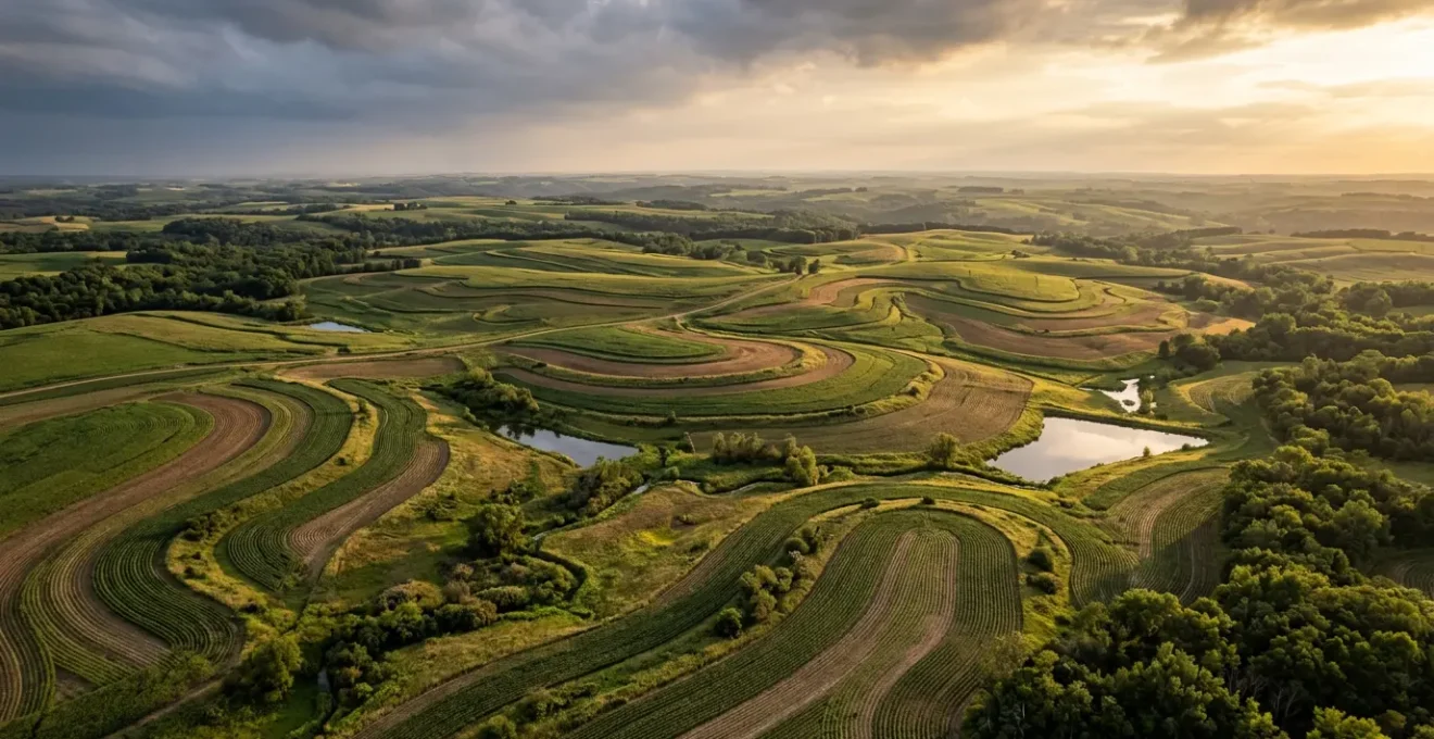
For farmers in Northern England and Scotland, the sight of saturated fields transforming into temporary lakes is becoming an all-too-common reality. The weather is no longer just unpredictable; it’s extreme. Conventional wisdom advises improving soil health or planting trees, and while these are valid components, they often fall short when faced with the sheer volume and velocity of a deluge. These measures are pieces of a puzzle, not the complete picture. The situation demands a fundamental shift in perspective.
The solution is not to simply cope with water, but to control it. This requires moving beyond traditional agronomy and adopting the mindset of a landscape hydration engineer. We must stop thinking of a farm as a collection of fields and start seeing it as an integrated hydrological control system. The real failure point during an extreme rainfall event isn’t the crop; it’s the landscape’s inability to slow, spread, and sink water effectively. The goal is to re-engineer the land to function as a massive sponge, turning a destructive force into a productive asset.
This guide deconstructs the structural components required to build this resilience. We will analyse the physics of on-contour water management, the critical flaws in outdated drainage philosophies, and the mechanical role of soil structure. By treating water management as an engineering discipline, you can build a farm that not only survives extreme weather but thrives because of it, protecting your assets and mitigating your impact on communities downstream.
To navigate these complex but critical engineering principles, this article is structured to build your understanding from the ground up. Each section addresses a specific structural component of a climate-resilient farm, providing the technical knowledge needed to design and implement a robust water management strategy.
Summary: Designing Climate-Smart Systems to Buffer Extreme Rainfall Events in the North?
- Why Keyline Ploughing Moves Water from Wet Valleys to Dry Ridges?
- How to Construct Swales to Capture Runoff on Hill Farms?
- Riparian Strips vs Engineered Bunds: Which Stops Pollution Better?
- The Field Drain Mistake That Accelerates Flooding Downstream
- Compaction Busting: How to Ensure Water Enters the Soil Profile Fast?
- How to Re-Wiggle Rivers to Restore Natural Hydrology?
- How to Deepen the A-Horizon by 2cm per Year Using Cover Crops?
- Managing the Hydrological Cycle to Prevent Downstream Flooding Liability?
Why Keyline Ploughing Moves Water from Wet Valleys to Dry Ridges?
Keyline design is a landscape engineering technique that uses the geometry of the land to manage water flow. In a typical undulating landscape, water naturally concentrates in valleys, leaving ridges dry and prone to drought stress. Keyline ploughing directly counters this by creating subsoil channels that are ploughed slightly off-contour. The plough lines gently drift downhill from the valley centre towards the ridge, intercepting surface and subsurface water flow and redirecting it from the wetter, more vigorous valley areas to the drier, less productive ridges. This isn’t just irrigation; it’s the creation of passive water harvesting infrastructure.
The system’s genius lies in its subtlety. By creating a pattern that encourages water to move slowly and laterally across the slope, it dramatically increases the time and surface area available for infiltration. This recharges the soil moisture profile across a much wider area of the farm. The effect is profound; research from Northern Ontario demonstrates that ridges on a Keyline-treated farm can retain up to four times more water than on a conventionally managed one. This turns vulnerable, low-productivity zones into resilient, hydrated assets, increasing the overall productive capacity of the landscape.
While the principles were developed in Australia, their application is universal for managing water on sloped land. The key is adapting the design to local conditions. For instance, in a case from New Mexico addressing hydrophobic sandy soils and compacted clay, the Keyline pattern of swales and berms was implemented to slow and spread water, with ongoing management required to see measurable results over five years. This highlights that Keyline is not a one-time fix, but the blueprint for an ongoing hydrological management strategy.
How to Construct Swales to Capture Runoff on Hill Farms?
Swales are one of the most powerful tools in the landscape engineer’s arsenal. A swale is essentially a long, level trench dug on contour, with the excavated earth piled on the downhill side to form a berm. Its function is simple but effective: it acts as a water velocity brake. When rainfall runs down a slope, it hits the swale, stops, and pools. This captured water is then given time to slowly soak into the ground, deeply hydrating the soil profile downhill from the swale. This passive irrigation technique is particularly crucial on the steep slopes common in Northern hill farms, transforming them from high-runoff zones into large-scale water harvesting systems.
The design and construction of a swale are critical to its function and stability. The structure must be perfectly on contour to ensure water spreads evenly along its length without overflowing at one end. The berm is typically planted with deep-rooted perennial vegetation, which acts as a living structural reinforcement, preventing erosion and stabilizing the earthwork.
As the illustration shows, the combination of the trench and vegetated berm creates a robust system. The roots of the plants on the berm form a dense web that holds the soil together, while their foliage provides an additional barrier to slow any potential overflow. This integrated biological and physical structure is far more resilient than a simple earthen dam. For farmers in high-rainfall areas, a network of swales can intercept and store thousands of gallons of water during a storm event, drastically reducing peak flow and preventing soil erosion.
Your Action Plan: Constructing an Effective Swale System
- Mark Contours: Use an A-frame level or laser level to precisely mark level contour lines across the slope where the swales will be located.
- Gather Tools & Assistance: Plan the excavation, whether by hand for small systems or with machinery for larger-scale projects. Ensure you have the necessary support.
- Excavate and Form Berm: Dig along the marked contour lines. Place all excavated soil on the downhill side of the trench to create a compacted berm.
- Determine Dimensions: Size the swale appropriately for your slope and rainfall. A typical width is 16-18 inches with a depth of 6-12 inches, but steeper slopes may require deeper and wider trenches.
- Plan Spacing: Space swales based on the steepness of the terrain. Steeper slopes require closer spacing to effectively intercept runoff before it gains velocity.
- Establish Vegetation: Immediately plant the berm with a mix of grasses, legumes, and other perennials to strengthen the structure and prevent the berm from eroding.
Riparian Strips vs Engineered Bunds: Which Stops Pollution Better?
When managing runoff at the field edge, particularly near watercourses, two primary engineering options emerge: vegetated riparian strips and constructed earthen bunds. A bund is a physical barrier, an engineered dam designed to hold back water and sediment. A riparian strip, however, is a biological engine. It’s a purposefully managed zone of permanent vegetation (grasses, shrubs, trees) that filters runoff through a complex living system. While both can be effective, they operate on fundamentally different principles, and for comprehensive pollution control, the biological system is demonstrably superior.
Engineered bunds excel at one thing: trapping sediment through physical impoundment. They are predictable and their storage capacity can be calculated. Riparian strips also trap sediment effectively; well-maintained grass riparian buffers achieve 90 to 95% sediment removal by slowing water velocity and allowing particles to settle out. But their real advantage lies in tackling dissolved pollutants like nitrates. The root zones of riparian vegetation create a carbon-rich, low-oxygen environment where soil microbes perform denitrification, converting harmful nitrates into harmless nitrogen gas. The efficiency is remarkable; multiple studies have documented over 85% nitrate removal within the first 5 meters of a buffer zone.
A structural bund offers no such biological processing. It is a passive container, whereas a riparian strip is an active filtration and processing plant that also offers co-benefits like habitat creation, carbon sequestration, and stream bank stabilization. The following comparison, based on data from numerous field studies, clarifies the trade-offs from an engineering perspective.
| Factor | Riparian Vegetation Strips | Engineered Bunds |
|---|---|---|
| Upfront Cost | Low to moderate | High (machinery, materials, construction) |
| Sediment Capture | High (60-95% depending on vegetation type) | Very high (physical barrier) |
| Nitrogen Removal | Very high (85%+ in first 5m via biological processes) | Moderate (physical trapping only) |
| Long-term Benefits | Habitat creation, biodiversity, carbon sequestration, temperature regulation | Predictable sediment control, quantifiable storage |
| Maintenance | Ongoing vegetation management, biomass removal | Structural integrity checks, sediment cleanout |
| Failure Risk | Low (gradual degradation) | Moderate to high (catastrophic berm failure possible) |
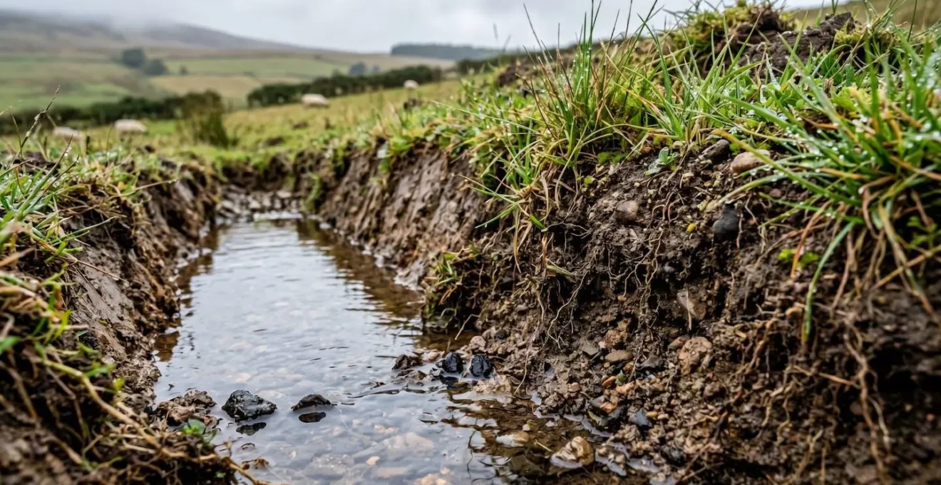
The Field Drain Mistake That Accelerates Flooding Downstream
For generations, the guiding principle of field drainage has been evacuation: get water off the land as quickly as possible. This approach, which treats water as a problem to be exported, is a primary contributor to downstream flooding. By installing extensive networks of tile drains that discharge directly into ditches and rivers, farms effectively become highly efficient funnels. During an extreme rainfall event, this system bypasses the landscape’s natural storage capacity (the soil sponge) and mainlines huge volumes of water into watercourses, overwhelming them and creating a significant downstream liability for communities and infrastructure.
The fundamental mistake is viewing drainage as a one-way street. A modern, resilient approach reframes it as a tool for adaptive water management. This involves installing control structures within the drainage system that allow the farmer to manage the water table actively. During dry periods, the outlets can be closed to hold water in the soil profile, conserving moisture and nutrients. During heavy rains, they can be opened to release excess water in a controlled manner, preventing waterlogging without contributing to flash flooding.
Case Study: Adaptive Drainage Management in Minnesota
In western Minnesota, a combination of increasingly heavy rainfall and the expansion of conventional tile drainage systems was directly linked to severe flooding in downstream communities. In response, watershed districts began regulating drainage to prevent the simple export of the problem. As one watershed district official noted, « We try to regulate what they do with tile drainage, not to keep them from doing it, but we try to do it in such a way that they don’t just move the problem from their location to somebody downstream. » A key solution being implemented involves water control structures on tile outlets. These devices transform the drainage network from a simple evacuation system into a dynamic storage tool, allowing farmers to raise and lower the water table as needed—retaining it during dry spells and releasing it cautiously during deluges.
We try to regulate what they do with tile drainage, not to keep them from doing it, but we try to do it in such a way that they don’t just move the problem from their location to somebody downstream.
– Watershed district official, Minnesota Public Radio climate adaptation reporting
Compaction Busting: How to Ensure Water Enters the Soil Profile Fast?
The single most important interface in landscape hydrology is the one between the air and the soil. If water cannot cross this boundary quickly, all other on-farm water management structures are put under immense pressure. Soil compaction, often caused by heavy machinery traffic especially on wet ground, creates a dense, impermeable layer or « plough pan » near the surface. This layer acts like a concrete floor, dramatically reducing the rate of water infiltration. Rain that should be soaking in instead runs off, initiating soil erosion and contributing to flash flooding. From an engineering perspective, compaction represents a catastrophic failure of the soil’s structural integrity.
Mechanical subsoiling can provide a temporary fix, but it is energy-intensive and its effects are often short-lived. A more sustainable and effective engineering solution is biological decompaction, or « biodrilling. » This involves using specific cover crops with powerful, deep taproots, such as daikon radish, chicory, or sweetclover. These plants are nature’s subsoilers. Their roots drive down through the compacted layer, creating deep, stable channels. When the plant dies, the root decomposes, leaving behind a network of macropores that act as conduits, guiding water deep into the soil profile.

This split-view clearly illustrates the difference. On one side, compacted soil throttles root growth and blocks water. On the other, a decompacted, well-structured soil, opened up by biological activity, allows for deep root penetration and provides a clear pathway for water infiltration. Building this structure is not a quick fix; it is an ongoing process of feeding the soil with organic matter and using plant biology to perform the heavy lifting. A soil with good structure and high porosity is the first and most important line of defence against runoff, acting as the primary reservoir in your farm’s hydrological control system.
How to Re-Wiggle Rivers to Restore Natural Hydrology?
For decades, river management was driven by an engineering philosophy of efficiency and control, which meant straightening, deepening, and canalising watercourses to move water away as fast as possible. This « hydraulic efficiency » has proven to be an ecological and hydrological disaster. A straight, channelised river is like a drainage pipe: it has minimal storage capacity and transmits flood pulses downstream at high velocity. Restoring natural hydrology involves undoing this damage by « re-wiggling » the river—a process known as re-meandering.
A meandering river is longer, has a gentler gradient, and features a complex sequence of deep pools and shallow riffles. This sinuous path acts as a natural braking system. Water takes far longer to travel through a meandering reach than a straight one, a concept known as increasing the hydraulic residence time. This slowing of the flow has two critical effects. First, it lowers the peak flood level downstream by desynchronizing the arrival of water from different parts of the A. Second, it allows the river to reconnect with its floodplain. During high flows, water spills out onto the adjacent floodplain, which acts as a vast, temporary storage area, further buffering the flood peak.
The process of re-meandering involves strategically placing structures like large woody debris or creating small pilot channels to encourage the river to carve a new, more sinuous path for itself. It is a shift from imposing a rigid, man-made form on the river to creating the conditions for it to restore its own dynamic, resilient geometry. This restored complexity also creates a huge diversity of habitats and kick-starts the hyporheic zone—the area beneath and alongside the stream bed where surface water and groundwater mix—which is critical for water quality and ecosystem health.
How to Deepen the A-Horizon by 2cm per Year Using Cover Crops?
The A-horizon, or topsoil, is the most biologically active and crucial layer of soil for agricultural productivity and water management. Its depth is a direct indicator of the health and resilience of the landscape. Building topsoil is an engineering process that balances the addition of new organic material against the natural rate of decomposition. Using a strategic, multi-species cover crop system, it is possible to achieve a net gain, systematically deepening the A-horizon year after year.
The mechanism is twofold. First, the continuous cover of living plants protects the soil surface from the erosive impact of rain and wind. More importantly, the plants are constantly pumping liquid carbon into the soil via root exudates. These sugary substances feed a vast army of soil microbes—bacteria, fungi, and protozoa. This microbial activity is the engine of soil creation. Microbes bind soil particles together into stable aggregates, creating the pore space essential for both air and water. Stable soil aggregates are the building blocks of a healthy A-horizon.
Second, at the end of its life, the entire cover crop—roots and shoots—is returned to the soil. The decomposition of this biomass provides the raw organic matter that becomes humus, the dark, stable, long-lasting component of topsoil that is legendary for its ability to hold water and nutrients. A diverse mix of cover crops is key: grasses provide a dense, fibrous root system for aggregation, legumes fix atmospheric nitrogen to fuel microbial activity, and brassicas provide deep taproots for decompaction. The goal is to maximize photosynthesis and biomass production for as many days of the year as possible, ensuring a constant supply of carbon to build and deepen that vital A-horizon.
Key Takeaways
- Water velocity is the enemy; every intervention, from swales to meanders, must be designed to slow the flow and increase residence time.
- Soil is not dirt; it is a porous engineering medium whose infiltration capacity must be actively built and protected from compaction.
- The farm is not an island; every drainage decision has a direct impact downstream, creating a legal and ethical liability that must be managed.
Managing the Hydrological Cycle to Prevent Downstream Flooding Liability?
We have deconstructed the individual engineering components of a climate-resilient farm: the water-spreading geometry of Keyline design, the velocity-braking power of swales, the biological filtration of riparian zones, and the structural importance of a decompacted, living soil. The final step is to integrate these elements into a single, cohesive system. Managing the hydrological cycle is not about implementing one technique; it is about orchestrating a suite of interventions that work together to control water at every stage, from the moment a raindrop hits the ground to the moment it leaves the farm boundary.
This integrated approach is the only effective way to mitigate the growing risk of downstream flooding liability. As rainfall patterns intensify, the legal and social pressure on landowners to manage their runoff will only increase. A farm that rapidly sheds water, contributing to flooding in a neighbouring village or overwhelming municipal infrastructure, is a significant liability. Conversely, a farm engineered to function as a landscape-scale sponge becomes a community asset—a piece of distributed, green infrastructure that provides a vital flood mitigation service.
The mindset shift from evacuation to infiltration, from drainage to storage, and from isolated fields to an integrated system is paramount. By viewing your entire farm through the lens of a hydrological engineer, you can design a landscape that is not only more productive and resilient to drought and deluge but also one that transforms a potential legal and financial risk into a verifiable public good. This is the future of agriculture in a changing climate.
The first step in re-engineering your landscape is a thorough hydrological audit. Begin today by mapping your contours, identifying compacted zones, and assessing your drainage outfalls to build a comprehensive plan for total water control.